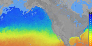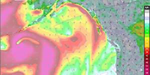
Here are two screen captures that show some of the types of outputs the Windalert software can generate. These can be produced by zooming into an area of interest in the map and then clicking on the “Click for More Data” button to open up the Windalert website where additional maps can be created such as sea surface temperature, wind prediction modeling, and many others. WindAlert is a very useful website for anglers.
Marine Weather Online Tools
There are some very good online tools for weather modelling that can be customized by users to show information specific to certain areas. An example is the following web app provided by WindAlert shows weather stations across North America. The map can be zoomed and panned. By clicking on the stations specific details can be queried.
Marine Weather Online Links
The following links will take you to GoogleMaps showing the current weather conditions and cloud cover in the particular areas. From there you can use the GoogleMaps interphase to zoom and pan around or click on the particular icons to get more details on specific locations.
